 "Spanfeller is a twat" (theaspiringengineer)
01/17/2019 at 23:33 • Filed to: None
 5
5
 3
3|
"Spanfeller is a twat" (theaspiringengineer)
01/17/2019 at 23:33 • Filed to: None | 5
| 3 |
The government of Mexico City made available !!!error: Indecipherable SUB-paragraph formatting!!! they have in their archives, and made an interactive website about it with the help from a local university called C.I.D.E.
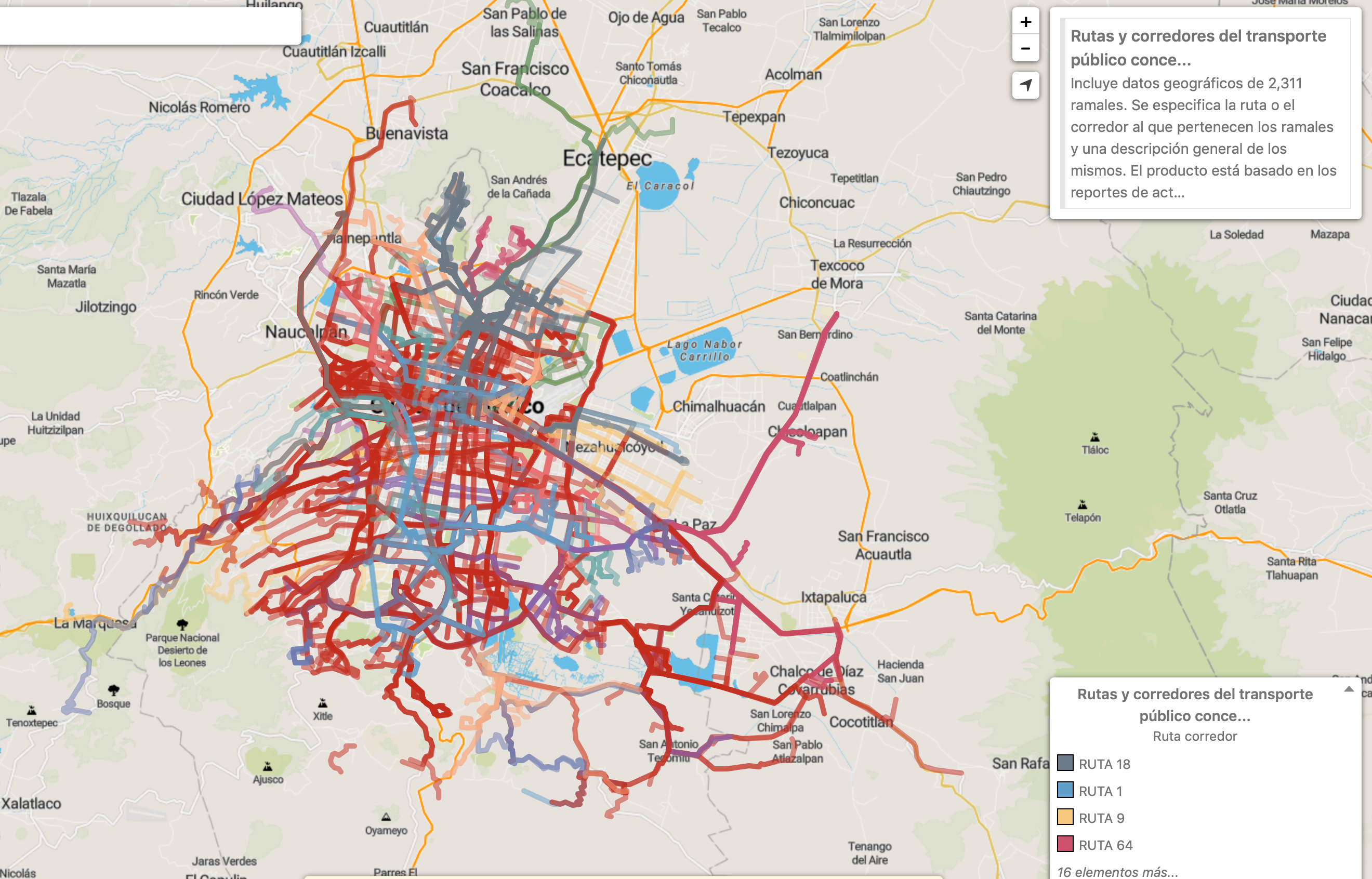
Some data is groundbreaking, like the routes that are available via Microbus
(
Consider this is the first time those routes have been digitalized)
; the privatized public transport system we despise but so desperately rely upon. Compare that with our Metro/BRT coverage...
!!! UNKNOWN CONTENT TYPE !!!
Everything from gunshot reports to “Snow condition danger” is represented in the site.... shame it’s in spanish though.
 and 100 more
> Spanfeller is a twat
and 100 more
> Spanfeller is a twat
01/18/2019 at 00:15 |
|
That is fantastic! Open data is awesome.
I was flipping thru netflix earlier and saw a new series called Diableros. The opening shot in the series is a pan over Mexico City. It is fuggin HUGE! And at least from the vantage point they showed, a lot of it is medium-rise, high- density units. The character mentions that he shares the city with 24 million people. Wow!
|
Spanfeller is a twat
> and 100 more
01/18/2019 at 00:20 |
|
I’m glad they made the data public and easy to access, it feels like a Cities Skylines mod!
“Mexico City” is many things...
32 million people live in the Megalopolis area and are subject to the same enviromental laws (even across state lines)
24 million people live in the Metropolitan area (the number some use to impress with the size)
9 million live in the city proper.
It is a huge city! But its kind of odd, our average density is very low, just 6000/km2... our most dense area is up to 16,000/km2!
|
and 100 more
> Spanfeller is a twat
01/18/2019 at 00:37 |
|
I think I'd like to visit some day. Everything I've been hearing about it lately, it seems like such a cool city.